
Los Pinos topographic map
Interactive map
Click on the map to display elevation.
About this map
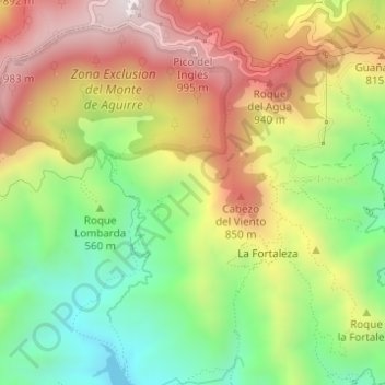
Name: Los Pinos topographic map, elevation, terrain.
Location: Los Pinos, Santa Cruz de Tenerife, Canarias, 38293, España (28.52324 -16.26489 28.52354 -16.26359)
Average elevation: 615 m
Minimum elevation: 255 m
Maximum elevation: 1,012 m
Other topographic maps
Click on a map to view its topography, its elevation and its terrain.
El Pilón
España > Canarias > Santa Cruz de Tenerife
El Pilón, Santa Cruz de Tenerife, Canarias, 38125, España
Average elevation: 432 m