
Sidi Fredj topographic map
Interactive map
Click on the map to display elevation.
About this map
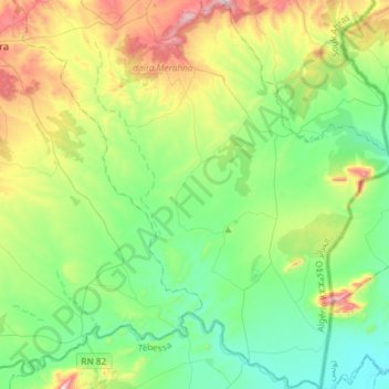
Name: Sidi Fredj topographic map, elevation, terrain.
Location: Sidi Fredj, daïra Merahna, Souk Ahras, Algérie (35.95690 8.11163 36.19510 8.34601)
Average elevation: 616 m
Minimum elevation: 407 m
Maximum elevation: 1,125 m