
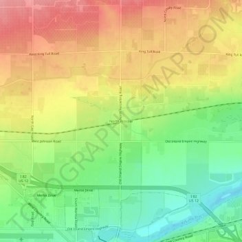
North Prosser topographic map
Interactive map
Click on the map to display elevation.
About this map
Name: North Prosser topographic map, elevation, terrain.
Average elevation: 231 m
Minimum elevation: 180 m
Maximum elevation: 282 m
Other topographic maps
Click on a map to view its topography, its elevation and its terrain.
Kennewick
United States > Washington > Benton County
Kennewick, Benton County, Washington, United States
Average elevation: 153 m
Hanford
United States > Washington > Benton County
Hanford, Benton County, Washington, United States
Average elevation: 123 m
Badger
United States > Washington > Benton County
Badger, Benton County, Washington, United States
Average elevation: 246 m
Kiona
United States > Washington > Benton County
Kiona, Benton County, Washington, 99320, United States
Average elevation: 224 m
Longview
United States > Washington > Benton County
Longview, Benton County, Washington, United States
Average elevation: 99 m
Plymouth
United States > Washington > Benton County
Plymouth, Benton County, Washington, 99346, United States
Average elevation: 105 m
Highland
United States > Washington > Benton County
Highland, Benton County, Washington, United States
Average elevation: 196 m
Whistran Wildlife Area
United States > Washington > Benton County
Whistran Wildlife Area, Benton County, Washington, United States
Average elevation: 233 m
Finley
United States > Washington > Benton County > Finley
Finley, Benton County, Washington, United States
Average elevation: 115 m
Paterson
United States > Washington > Benton County
Paterson, Benton County, Washington, United States
Average elevation: 125 m
Benton City
United States > Washington > Benton County
Benton City, Benton County, Washington, United States
Average elevation: 190 m
West Richland
United States > Washington > Benton County
West Richland, Benton County, Washington, 99353, United States
Average elevation: 146 m
Kennewick
United States > Washington > Benton County > Kennewick
Kennewick, Benton County, Washington, 99337, United States
Average elevation: 224 m
Prosser
United States > Washington > Benton County > Prosser > Prosser
Prosser, Benton County, Washington, 99350-1300, United States
Average elevation: 294 m
Richland
United States > Washington > Benton County
Richland, Benton County, Washington, United States
Average elevation: 160 m
Prosser
United States > Washington > Benton County
Prosser, Benton County, Washington, 99350, United States
Average elevation: 280 m
Audrey
United States > Washington > Benton County
Audrey, Benton County, Washington, United States
Average elevation: 156 m