
Schmiedefeld am Rennsteig topographic map
Interactive map
Click on the map to display elevation.
About this map
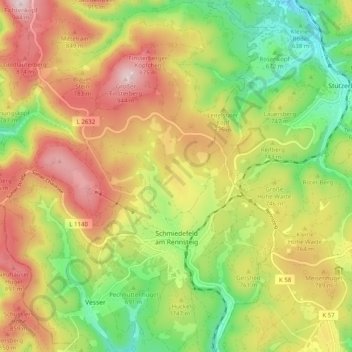
Name: Schmiedefeld am Rennsteig topographic map, elevation, terrain.
Location: Schmiedefeld am Rennsteig, Suhl, Thüringen, Duitsland (50.58796 10.77278 50.65120 10.84262)
Average elevation: 743 m
Minimum elevation: 564 m
Maximum elevation: 937 m
Other topographic maps
Click on a map to view its topography, its elevation and its terrain.