
Champia topographic map
Interactive map
Click on the map to display elevation.
About this map
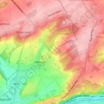
Name: Champia topographic map, elevation, terrain.
Location: Champia, Wanze, Huy, Liège, Wallonie, 4520, Belgique (50.53507 5.22338 50.57507 5.26338)
Average elevation: 149 m
Minimum elevation: 55 m
Maximum elevation: 206 m
Other topographic maps
Click on a map to view its topography, its elevation and its terrain.
Le Tilleul
Belgique > Liège > Huy > Wanze > Le Tilleul
Le Tilleul, Wanze, Huy, Liège, Wallonie, 4520, Belgique
Average elevation: 119 m