
Cantón San Isidro topographic map
Interactive map
Click on the map to display elevation.
About this map
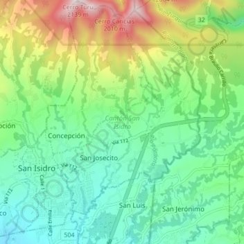
Name: Cantón San Isidro topographic map, elevation, terrain.
Location: Cantón San Isidro, Heredia, Costa Rica (9.99631 -84.07592 10.06312 -84.01020)
Average elevation: 1,488 m
Minimum elevation: 1,217 m
Maximum elevation: 2,109 m
Other topographic maps
Click on a map to view its topography, its elevation and its terrain.
Barreal
Costa Rica > Heredia > Barreal
Barreal, Cantón Heredia, Heredia, 40104, Costa Rica
Average elevation: 1,028 m