
Oblast de Cheliabinsk topographic map
Interactive map
Click on the map to display elevation.
About this map
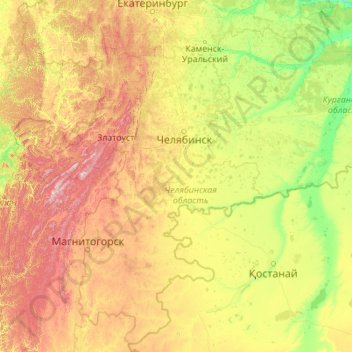
Name: Oblast de Cheliabinsk topographic map, elevation, terrain.
Location: Oblast de Cheliabinsk, Уральский федеральный округ, Rússia (51.86240 58.62658 56.98240 63.74658)
Average elevation: 288 m
Minimum elevation: 54 m
Maximum elevation: 1,466 m
Other topographic maps
Click on a map to view its topography, its elevation and its terrain.