
Luena River topographic map
Interactive map
Click on the map to display elevation.
About this map
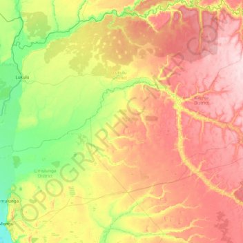
Name: Luena River topographic map, elevation, terrain.
Location: Luena River, Western Province, Zambia (-14.90163 23.00611 -14.39256 24.53245)
Average elevation: 1,095 m
Minimum elevation: 1,011 m
Maximum elevation: 1,215 m
Other topographic maps
Click on a map to view its topography, its elevation and its terrain.
Mongu
Mongu, Mongu District, Western Province, Zambia
Average elevation: 1,037 m
Sioma Ngwezi National Park
Sioma Ngwezi National Park, RD324, Western Province, Zambia
Average elevation: 973 m