
Rubielos de Mora topographic map
Interactive map
Click on the map to display elevation.
About this map
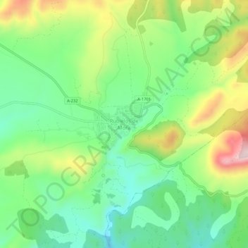
Name: Rubielos de Mora topographic map, elevation, terrain.
Location: Rubielos de Mora, Gúdar-Javalambre, Teruel, Aragón, España (40.17044 -0.67193 40.21044 -0.63193)
Average elevation: 979 m
Minimum elevation: 847 m
Maximum elevation: 1,209 m