
Phayao Province topographic map
Interactive map
Click on the map to display elevation.
About this map
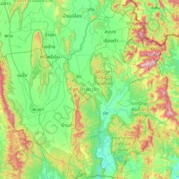
Name: Phayao Province topographic map, elevation, terrain.
Location: Phayao Province, Thailand (18.80660 99.68719 19.73551 100.63416)
Average elevation: 551 m
Minimum elevation: 242 m
Maximum elevation: 1,735 m
Other topographic maps
Click on a map to view its topography, its elevation and its terrain.
Chiang Kham
Thailand > Phayao Province > Chiang Kham
Chiang Kham, Phayao Province, 56110, Thailand
Average elevation: 398 m