
เกาะเต่า topographic map
Interactive map
Click on the map to display elevation.
About this map
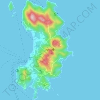
Name: เกาะเต่า topographic map, elevation, terrain.
Location: เกาะเต่า, Surat Thani, Thailand (10.05805 99.81510 10.12622 99.85582)
Average elevation: 35 m
Minimum elevation: -1 m
Maximum elevation: 352 m