
Sengie topographic map
Interactive map
Click on the map to display elevation.
About this map
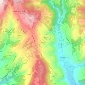
Name: Sengie topographic map, elevation, terrain.
Location: Sengie, Lugo, Grezzana, Verona, Venetien, Italien (45.55457 10.95933 45.59457 10.99933)
Average elevation: 536 m
Minimum elevation: 252 m
Maximum elevation: 853 m