
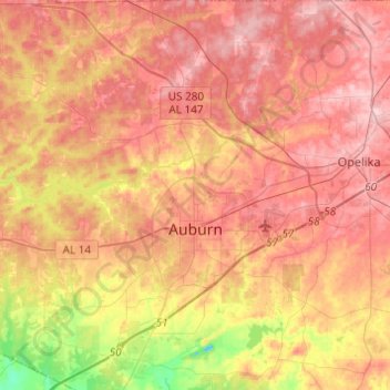
Auburn topographic map
Interactive map
Click on the map to display elevation.
About this map
Name: Auburn topographic map, elevation, terrain.
Location: Auburn, Lee County, Alabama, États-Unis d'Amérique (32.52501 -85.58352 32.73062 -85.40447)
Average elevation: 200 m
Minimum elevation: 94 m
Maximum elevation: 267 m
Other topographic maps
Click on a map to view its topography, its elevation and its terrain.
Auburn
États-Unis d'Amérique > Alabama > Lee County > Auburn
Auburn, Lee County, Alabama, États-Unis d'Amérique
Average elevation: 139 m