
Canne topographic map
Interactive map
Click on the map to display elevation.
About this map
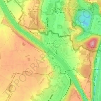
Name: Canne topographic map, elevation, terrain.
Location: Canne, Riemst, Tongres, Limbourg, Flandre, Belgique (50.80388 5.64083 50.82008 5.68816)
Average elevation: 87 m
Minimum elevation: 10 m
Maximum elevation: 153 m
Other topographic maps
Click on a map to view its topography, its elevation and its terrain.