
Muncie topographic map
Interactive map
Click on the map to display elevation.
About this map
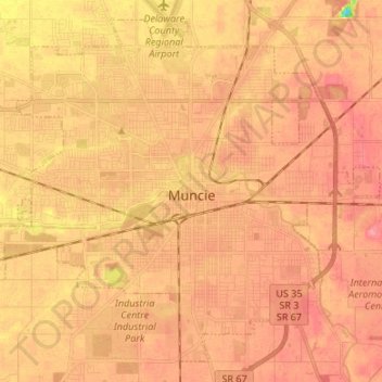
Name: Muncie topographic map, elevation, terrain.
Location: Muncie, Delaware County, Indiana, United States (40.14910 -85.45445 40.24070 -85.32067)
Average elevation: 291 m
Minimum elevation: 237 m
Maximum elevation: 313 m
Other topographic maps
Click on a map to view its topography, its elevation and its terrain.
Selma
United States > Indiana > Delaware County
Selma, Delaware County, Indiana, United States
Average elevation: 304 m
Yorktown
United States > Indiana > Delaware County > Yorktown
Yorktown, Delaware County, Indiana, United States
Average elevation: 282 m
Eaton
United States > Indiana > Delaware County > Eaton
Eaton, Delaware County, Indiana, 47338, United States
Average elevation: 279 m