
Thank you for supporting this site ❤️
Make a donation
Make a donation
Kabwe topographic map
Click on the map to display elevation.
Thank you for supporting this site ❤️
Make a donation
Make a donation
About this map
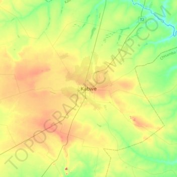
Name: Kabwe topographic map, elevation, terrain.
Location: Kabwe, Kabwe District, Central Province, Zambia (-14.60341 28.28652 -14.28341 28.60652)
Average elevation: 1,170 m
Minimum elevation: 1,109 m
Maximum elevation: 1,261 m
Thank you for supporting this site ❤️
Make a donation
Make a donation
Other topographic maps
Click on a map to view its topography, its elevation and its terrain.