
固增苗族乡 topographic map
Interactive map
Click on the map to display elevation.
About this map
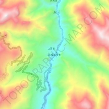
Name: 固增苗族乡 topographic map, elevation, terrain.
Location: 固增苗族乡, 木里藏族自治县, 凉山彝族自治州, 四川省, 中国 (28.24447 100.82270 28.32447 100.90270)
Average elevation: 2,899 m
Minimum elevation: 2,099 m
Maximum elevation: 3,925 m
Other topographic maps
Click on a map to view its topography, its elevation and its terrain.