
Lake Powell Park topographic map
Interactive map
Click on the map to display elevation.
About this map
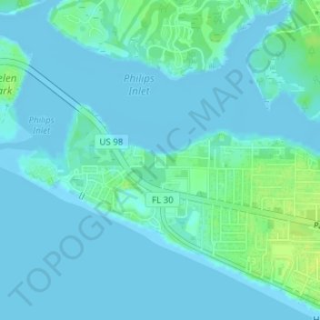
Name: Lake Powell Park topographic map, elevation, terrain.
Location: Lake Powell Park, Bay County, Florida, United States (30.26693 -85.97584 30.26806 -85.97475)
Average elevation: 3 m
Minimum elevation: -3 m
Maximum elevation: 15 m
Other topographic maps
Click on a map to view its topography, its elevation and its terrain.
Fountain
United States > Florida > Bay County
Fountain, Bay County, Florida, 32438, United States
Average elevation: 51 m
Lower Grand Lagoon
United States > Florida > Bay County > Lower Grand Lagoon
Lower Grand Lagoon, Bay County, Florida, United States
Average elevation: 2 m
Gulf Resort Beach
United States > Florida > Bay County > Panama City Beach
Gulf Resort Beach, Panama City Beach, Bay County, Florida, 32414, United States
Average elevation: 5 m
Long Point
United States > Florida > Bay County > Parker
Long Point, Parker, Bay County, Florida, 32403, United States
Average elevation: 2 m
Panama City
United States > Florida > Bay County
Panama City, Bay County, Florida, United States
Average elevation: 6 m
Panama City Beach
United States > Florida > Bay County
Panama City Beach, Bay County, Florida, United States
Average elevation: 2 m
Mexico Beach
United States > Florida > Bay County
Mexico Beach, Bay County, Florida, 32410, United States
Average elevation: 2 m