
Thank you for supporting this site ❤️
Make a donation
Make a donation
Rājāwāla topographic map
Click on the map to display elevation.
Thank you for supporting this site ❤️
Make a donation
Make a donation
About this map
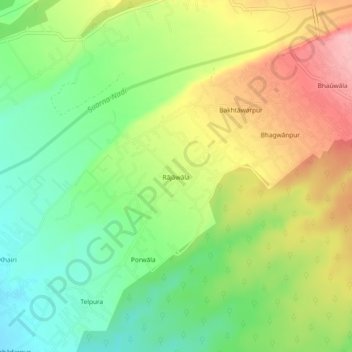
Name: Rājāwāla topographic map, elevation, terrain.
Location: Rājāwāla, Vikasnagar, Dehradun, Uttarakhand, 248011, India (30.36753 77.87610 30.40753 77.91610)
Average elevation: 615 m
Minimum elevation: 551 m
Maximum elevation: 697 m
Thank you for supporting this site ❤️
Make a donation
Make a donation