
Boynton topographic map
Interactive map
Click on the map to display elevation.
About this map
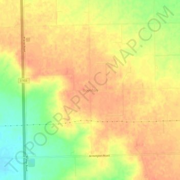
Name: Boynton topographic map, elevation, terrain.
Location: Boynton, Tazewell County, Illinois, États-Unis d'Amérique (40.33226 -89.45538 40.37226 -89.41538)
Average elevation: 210 m
Minimum elevation: 180 m
Maximum elevation: 224 m
Other topographic maps
Click on a map to view its topography, its elevation and its terrain.
Green Valley
États-Unis d'Amérique > Illinois > Tazewell County
Green Valley, Tazewell County, Illinois, États-Unis d'Amérique
Average elevation: 164 m