
Cedar Glen topographic map
Interactive map
Click on the map to display elevation.
About this map
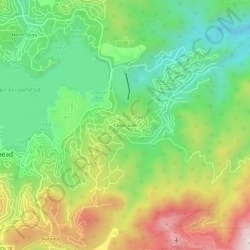
Name: Cedar Glen topographic map, elevation, terrain.
Average elevation: 1,640 m
Minimum elevation: 1,435 m
Maximum elevation: 1,954 m
Other topographic maps
Click on a map to view its topography, its elevation and its terrain.
North Shore
United States > California > San Bernardino County > Lake Arrowhead
North Shore, Lake Arrowhead, San Bernardino County, California, 92352, United States
Average elevation: 1,585 m