
Thank you for supporting this site ❤️
Make a donation
Make a donation
Aley topographic map
Click on the map to display elevation.
Thank you for supporting this site ❤️
Make a donation
Make a donation
About this map
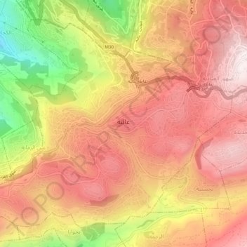
Name: Aley topographic map, elevation, terrain.
Location: Aley, Aley District, Mount Lebanon Governorate, 1501, Lebanon (33.79108 35.57940 33.82469 35.62734)
Average elevation: 775 m
Minimum elevation: 318 m
Maximum elevation: 1,047 m
Thank you for supporting this site ❤️
Make a donation
Make a donation