
Río Najerilla topographic map
Interactive map
Click on the map to display elevation.
About this map
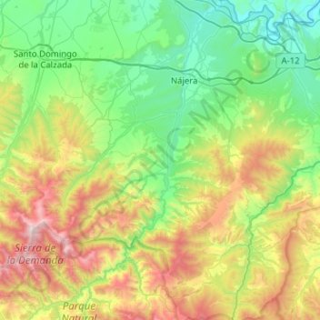
Name: Río Najerilla topographic map, elevation, terrain.
Location: Río Najerilla, Anguiano, La Rioja, 26300, España (42.13555 -2.97791 42.50921 -2.67374)
Average elevation: 931 m
Minimum elevation: 380 m
Maximum elevation: 2,266 m
Other topographic maps
Click on a map to view its topography, its elevation and its terrain.