
Thank you for supporting this site ❤️
Make a donation
Make a donation
Shepherdstown topographic map
Click on the map to display elevation.
Thank you for supporting this site ❤️
Make a donation
Make a donation
About this map
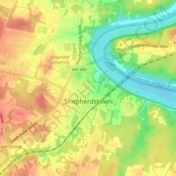
Name: Shepherdstown topographic map, elevation, terrain.
Average elevation: 126 m
Minimum elevation: 90 m
Maximum elevation: 154 m
Thank you for supporting this site ❤️
Make a donation
Make a donation
Other topographic maps
Click on a map to view its topography, its elevation and its terrain.
Kearneysville
United States > West Virginia > Jefferson County > Kearneysville
Average elevation: 162 m
Thank you for supporting this site ❤️
Make a donation
Make a donation