
Kostinbrod topographic map
Interactive map
Click on the map to display elevation.
About this map
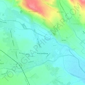
Name: Kostinbrod topographic map, elevation, terrain.
Location: Kostinbrod, Sofia, 2230, Bulgaria (42.80077 23.17515 42.83679 23.23482)
Average elevation: 547 m
Minimum elevation: 524 m
Maximum elevation: 613 m