
Borough of Blackpool topographic map
Interactive map
Click on the map to display elevation.
About this map
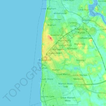
Name: Borough of Blackpool topographic map, elevation, terrain.
Location: Borough of Blackpool, England, United Kingdom (53.77310 -3.07642 53.87590 -2.98334)
Average elevation: 7 m
Minimum elevation: 0 m
Maximum elevation: 39 m
Other topographic maps
Click on a map to view its topography, its elevation and its terrain.
Reading
United Kingdom > England > Reading
Mary Russell Mitford lived in Reading for a number of years and then spent the rest of her life just outside the town at Three Mile Cross and Swallowfield. The fictional Belford Regis of her eponymous novel, first published in 1835, is largely based on Reading. Described with topographical accuracy, it is…
Average elevation: 56 m
Wakebridge
United Kingdom > England > Derbyshire > Amber Valley > Crich Carr > Wakebridge
Average elevation: 181 m