
寺坞岭 topographic map
Interactive map
Click on the map to display elevation.
About this map
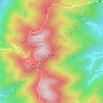
Name: 寺坞岭 topographic map, elevation, terrain.
Location: 寺坞岭, 杭州市, 浙江省, 中国 (30.04550 120.13216 30.04560 120.13226)
Average elevation: 286 m
Minimum elevation: 38 m
Maximum elevation: 516 m
Other topographic maps
Click on a map to view its topography, its elevation and its terrain.