
南丰镇 topographic map
Interactive map
Click on the map to display elevation.
About this map
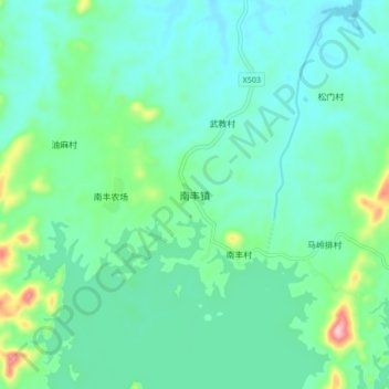
Name: 南丰镇 topographic map, elevation, terrain.
Location: 南丰镇, 儋州市, 海南省, 中国 (19.37984 109.50774 19.45984 109.58774)
Average elevation: 185 m
Minimum elevation: 140 m
Maximum elevation: 363 m
Other topographic maps
Click on a map to view its topography, its elevation and its terrain.