
Monte Le Senate topographic map
Interactive map
Click on the map to display elevation.
About this map
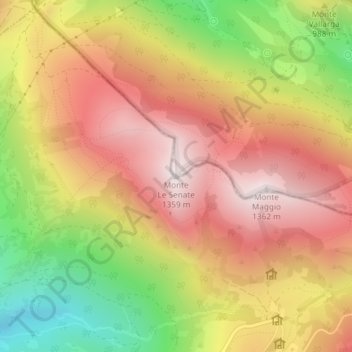
Name: Monte Le Senate topographic map, elevation, terrain.
Location: Monte Le Senate, Gualdo Tadino, Perugia, Umbria, 06023, Italia (43.26987 12.80410 43.26997 12.80420)
Average elevation: 980 m
Minimum elevation: 492 m
Maximum elevation: 1,350 m
Other topographic maps
Click on a map to view its topography, its elevation and its terrain.
Petroia
Italia > Umbria > Perugia > Gualdo Tadino
Petroia, Gualdo Tadino, Perugia, Umbria, 06023, Italia
Average elevation: 682 m