
Nuku Hiva topographic map
Interactive map
Click on the map to display elevation.
About this map
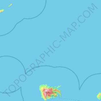
Name: Nuku Hiva topographic map, elevation, terrain.
Average elevation: 10 m
Minimum elevation: 0 m
Maximum elevation: 1,199 m
On the western edge of To'ovi'i rises Tekao, the island's highest peak, which reaches an elevation of 1224 m (4,016 ft). The western and northern edges of To'ovi'i are a mountain ridge, which catches much of the rain that waters the island.
Other topographic maps
Click on a map to view its topography, its elevation and its terrain.
Motu One
France > French Polynesia > Nuku Hiva
Motu One, Nuku Hiva, Marquesas Islands, French Polynesia, 98742, France
Average elevation: 0 m