
Midland County topographic map
Interactive map
Click on the map to display elevation.
About this map
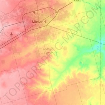
Name: Midland County topographic map, elevation, terrain.
Location: Midland County, Texas, États-Unis d'Amérique (31.65132 -102.28744 32.08699 -101.77566)
Average elevation: 842 m
Minimum elevation: 777 m
Maximum elevation: 899 m
Other topographic maps
Click on a map to view its topography, its elevation and its terrain.
Midland
États-Unis d'Amérique > Texas > Midland County > Midland
Midland, Midland County, Texas, États-Unis d'Amérique
Average elevation: 855 m