
曼夺 topographic map
Interactive map
Click on the map to display elevation.
About this map
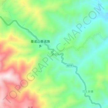
Name: 曼夺 topographic map, elevation, terrain.
Location: 曼夺, 景洪市, 西双版纳傣族自治州, 云南省, 666100, 中国 (22.01507 100.98952 22.05507 101.02952)
Average elevation: 992 m
Minimum elevation: 774 m
Maximum elevation: 1,361 m
Other topographic maps
Click on a map to view its topography, its elevation and its terrain.