
Costa de Lavos topographic map
Interactive map
Click on the map to display elevation.
About this map
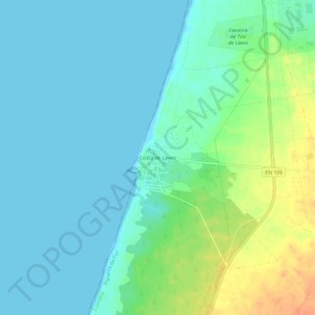
Name: Costa de Lavos topographic map, elevation, terrain.
Average elevation: 11 m
Minimum elevation: 0 m
Maximum elevation: 40 m
Other topographic maps
Click on a map to view its topography, its elevation and its terrain.
Regalheiras
Portugal > Coimbra > Figueira da Foz > Lavos
Regalheiras, Lavos, Figueira da Foz, Coimbra, 3080, Portugal
Average elevation: 35 m