
Kamniška Bistrica topographic map
Interactive map
Click on the map to display elevation.
About this map
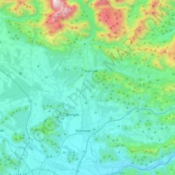
Name: Kamniška Bistrica topographic map, elevation, terrain.
Location: Kamniška Bistrica, Slovenia (46.07599 14.58846 46.32790 14.63986)
Average elevation: 554 m
Minimum elevation: 247 m
Maximum elevation: 2,151 m
Other topographic maps
Click on a map to view its topography, its elevation and its terrain.