
Kigoma Urban topographic map
Interactive map
Click on the map to display elevation.
About this map
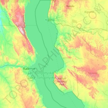
Name: Kigoma Urban topographic map, elevation, terrain.
Location: Kigoma Urban, Kigoma, Western Zone, Tanzanie (-6.80500 29.32698 -4.44791 30.25139)
Average elevation: 1,082 m
Minimum elevation: 698 m
Maximum elevation: 2,671 m
Other topographic maps
Click on a map to view its topography, its elevation and its terrain.