
库尔德宁镇 topographic map
Interactive map
Click on the map to display elevation.
About this map
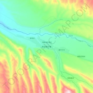
Name: 库尔德宁镇 topographic map, elevation, terrain.
Location: 库尔德宁镇, 巩留县, 伊犁哈萨克自治州, 新疆维吾尔自治区, 中国 (43.23662 82.63685 43.31662 82.71685)
Average elevation: 1,183 m
Minimum elevation: 994 m
Maximum elevation: 1,526 m
Other topographic maps
Click on a map to view its topography, its elevation and its terrain.