
El Milagro topographic map
Interactive map
Click on the map to display elevation.
About this map
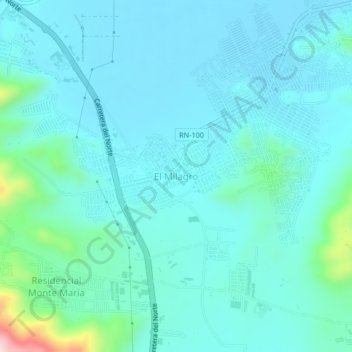
Name: El Milagro topographic map, elevation, terrain.
Location: El Milagro, Villanueva, Cortés, Honduras (15.36234 -88.00282 15.40234 -87.96282)
Average elevation: 80 m
Minimum elevation: 30 m
Maximum elevation: 388 m
Other topographic maps
Click on a map to view its topography, its elevation and its terrain.