
Kalte Ruhe topographic map
Interactive map
Click on the map to display elevation.
About this map
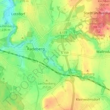
Name: Kalte Ruhe topographic map, elevation, terrain.
Location: Kalte Ruhe, Radeberg, Bautzen, Sachsen, 01454, Deutschland (51.09287 13.90856 51.13287 13.94856)
Average elevation: 254 m
Minimum elevation: 217 m
Maximum elevation: 299 m
Other topographic maps
Click on a map to view its topography, its elevation and its terrain.
Friedrichstal
Deutschland > Sachsen > Bautzen > Radeberg > Friedrichstal
Friedrichstal, Radeberg, Bautzen, Sachsen, 01454, Deutschland
Average elevation: 258 m
Großerkmannsdorf
Deutschland > Sachsen > Bautzen > Radeberg > Großerkmannsdorf
Großerkmannsdorf, Radeberg, Bautzen, Sachsen, 01454, Deutschland
Average elevation: 268 m