
Gandhi Sagar Dam topographic map
Interactive map
Click on the map to display elevation.
About this map
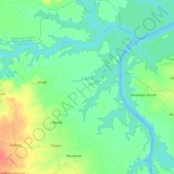
Name: Gandhi Sagar Dam topographic map, elevation, terrain.
Average elevation: 400 m
Minimum elevation: 385 m
Maximum elevation: 431 m
Other topographic maps
Click on a map to view its topography, its elevation and its terrain.
Narayangarh
India > Madhya Pradesh > Malhargarh Tahsil > Narayangarh
Narayangarh, Malhargarh Tahsil, Mandsaur, Madhya Pradesh, 458553, India
Average elevation: 447 m