
Phù Cát topographic map
Interactive map
Click on the map to display elevation.
About this map
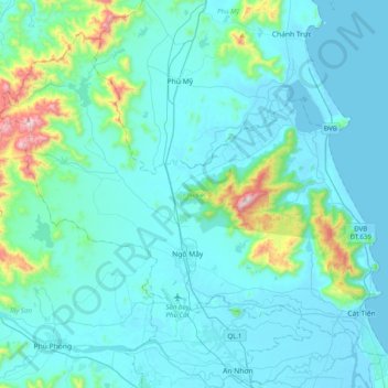
Name: Phù Cát topographic map, elevation, terrain.
Location: Phù Cát, Bình Định, Vietnam (13.90134 108.86787 14.22235 109.26585)
Average elevation: 98 m
Minimum elevation: -2 m
Maximum elevation: 873 m