
Fire Island topographic map
Interactive map
Click on the map to display elevation.
About this map
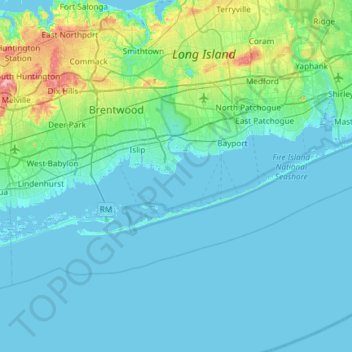
Name: Fire Island topographic map, elevation, terrain.
Location: Fire Island, Suffolk County, New York, 11770, USA (40.62026 -73.31411 40.77933 -72.72765)
Average elevation: 13 m
Minimum elevation: -2 m
Maximum elevation: 113 m