
Cienega topographic map
Interactive map
Click on the map to display elevation.
About this map
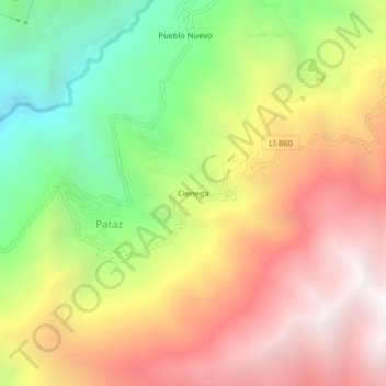
Name: Cienega topographic map, elevation, terrain.
Location: Cienega, Pataz, Patáz, Province of Pataz, La Libertad, Peru (-7.80291 -77.60461 -7.76291 -77.56461)
Average elevation: 3,092 m
Minimum elevation: 1,906 m
Maximum elevation: 4,220 m