
Grand Bahama topographic map
Interactive map
Click on the map to display elevation.
About this map
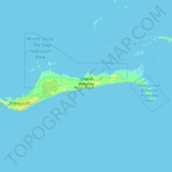
Name: Grand Bahama topographic map, elevation, terrain.
Location: Grand Bahama, The Bahamas (26.49051 -78.99941 26.77759 -77.89857)
Average elevation: 0 m
Minimum elevation: -2 m
Maximum elevation: 15 m
Other topographic maps
Click on a map to view its topography, its elevation and its terrain.
Grand Bahama
The Bahamas > East Grand Bahama
Grand Bahama, East Grand Bahama, The Bahamas
Average elevation: 1 m