
Dar es Salam topographic map
Interactive map
Click on the map to display elevation.
About this map
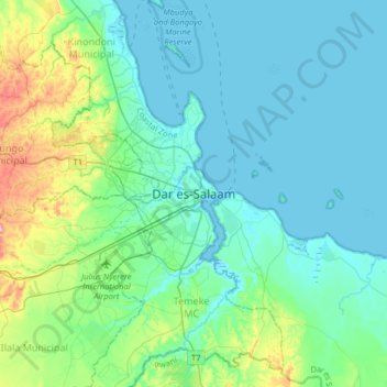
Name: Dar es Salam topographic map, elevation, terrain.
Location: Dar es Salam, Coastal Zone, 11101, Tanzanie (-6.97608 39.12036 -6.65608 39.44036)
Average elevation: 37 m
Minimum elevation: -2 m
Maximum elevation: 215 m
Other topographic maps
Click on a map to view its topography, its elevation and its terrain.
Kinondoni
Kinondoni, Kinondoni Municipal, Dar es Salam, Coastal Zone, 14110, Tanzanie
Average elevation: 12 m