
Flores topographic map
Interactive map
Click on the map to display elevation.
About this map
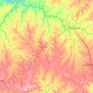
Name: Flores topographic map, elevation, terrain.
Location: Flores, Uruguay (-33.98479 -57.36087 -33.11902 -56.39648)
Average elevation: 109 m
Minimum elevation: 33 m
Maximum elevation: 202 m
Other topographic maps
Click on a map to view its topography, its elevation and its terrain.