
Herstappe topographic map
Interactive map
Click on the map to display elevation.
About this map
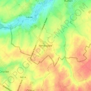
Name: Herstappe topographic map, elevation, terrain.
Location: Herstappe, Limbourg, Flandre, 3717, Belgique (50.70738 5.40609 50.74738 5.44609)
Average elevation: 121 m
Minimum elevation: 91 m
Maximum elevation: 146 m