
Kingsbury County topographic map
Interactive map
Click on the map to display elevation.
About this map
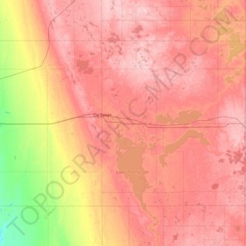
Name: Kingsbury County topographic map, elevation, terrain.
Location: Kingsbury County, South Dakota, USA (44.19593 -97.85295 44.54534 -97.12808)
Average elevation: 510 m
Minimum elevation: 403 m
Maximum elevation: 577 m
Other topographic maps
Click on a map to view its topography, its elevation and its terrain.
Missouri River
Missouri River, Sully County, South Dakota, 64072, USA
Average elevation: 901 m
Sisseton
USA > South Dakota > Sisseton
Sisseton, Roberts County, South Dakota, 57262, USA
Average elevation: 376 m
Angostura Recreation Area
Angostura Recreation Area, Fall River County, South Dakota, USA
Average elevation: 990 m