
乐余镇 topographic map
Interactive map
Click on the map to display elevation.
About this map
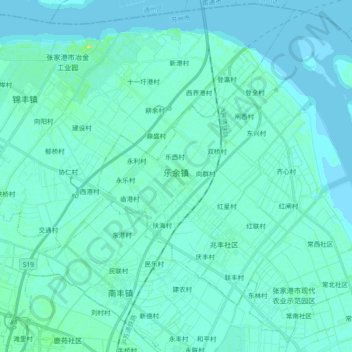
Name: 乐余镇 topographic map, elevation, terrain.
Location: 乐余镇, 张家港市, 苏州市, 江苏省, 中国 (31.85466 120.65845 32.00347 120.84369)
Average elevation: 3 m
Minimum elevation: -1 m
Maximum elevation: 22 m
Other topographic maps
Click on a map to view its topography, its elevation and its terrain.