
胡家镇 topographic map
Interactive map
Click on the map to display elevation.
About this map
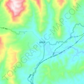
Name: 胡家镇 topographic map, elevation, terrain.
Location: 胡家镇, 宣汉县, 达州市, 四川省, 中国 (31.52447 107.61669 31.60447 107.69669)
Average elevation: 562 m
Minimum elevation: 342 m
Maximum elevation: 1,201 m
Other topographic maps
Click on a map to view its topography, its elevation and its terrain.