
德党镇 topographic map
Interactive map
Click on the map to display elevation.
About this map
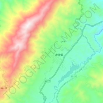
Name: 德党镇 topographic map, elevation, terrain.
Location: 德党镇, 临沧市, 云南省, 中国 (23.99004 99.21078 24.07004 99.29078)
Average elevation: 1,776 m
Minimum elevation: 1,264 m
Maximum elevation: 2,631 m
Other topographic maps
Click on a map to view its topography, its elevation and its terrain.